
I’ve known about NASA’s GLOBE program for a long time . It’s a very long running “citizen science” project. I was introduced to it by real NASA scientists who really use the data, and really need this data.
The idea is simple. NASA satellites record images of the Earth from orbit. These images are analyzed by algorithms which measure many things based on the images. These measurements are done extremely carefully, cross checking with as many sources of data as possible. One of the most important cross checks is to compare what the satellite data analysis says with what is actually happening down here on Earth!
This is what satellite science calls “ground truth”.
One of the things that the satellites see is clouds. For some scientists, clouds are in the way of what they want to see (e.g., oceans or forests), so they are discarded. For other scientists, clouds are what they are looking for, because they study weather, storms, and the atmosphere.
Talking to friends at NASA, I have learned that these cloud-o-philes face many challenges. One of the basic ones is how to identify what is a “cloud” what isn’t in a satellite image. For scientific models it is crucial to have a reasonable (and consistent) measure of where clouds are at each observation point and time. Practically, this means that each pixel needs to be marked as either “cloud” or not, according to some reproducible algorithm.
This task isn’t in any way trivial. Clouds vary. Some are obvious, thick, well-defined blobs. But what about wispy clouds that feather away into nothing? Where is the edge, or at least where should be define the edge to be? And what about haze? Fog? Ocean spray? Blowing ice crystals? Clouds are 3D, and many times there are multiple layers of clouds. And then there is nice white snow, which is pretty much the same color as the clouds overhead. So how do you even tell what is cloud and what is snow? And so on. The algorithms need to define what kind of clouds it is reporting, and accurately report them.
NASA scientists have worked very hard for several decades to develop accurate measurements of the Earth from satellite images. There are sophisticated algorithms for measuring clouds and that recognize things like major storms, amount of and so on. These algorithms run on data everyday, which is fed into ever more sophisticated theoretical models of the Earth’s atmosphere, in order to understand and predict weather and climate.
This whole cloud enterprise depends on one crucial question: just how accurate are those estimates of clouds? Are those clouds really there? What do they look like from underneath? If the satellite data says there is a cloud, is that always true? (OK—we’ll take “almost always”, so long as we understand the likely errors.)
This is the “ground truth” they need. The obvious thing to do is go outside and look up when the satellite is looking down, and record what you see from down here. And, believe me, scientists definitely do that.
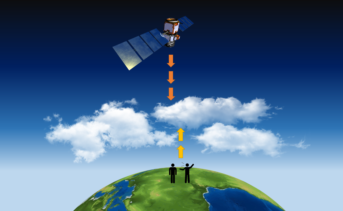
But the satellites fly over the whole Earth, and take pictures all the time. It’s not possible for any one person or group to be everywhere all the time.
The idea of project GLOBE was and is to recruit school kids around the world to look up, record what they see, and send in the observations . Actually, we really want someone looking up at exactly the time the satellite is looking down at them, so the project lets people know when various satellites are overhead. The GLOBE project was started in 1994 (!), when the Internet technology became available so people could email in their observations.
Pretty cool. Ordinary people contributing important data to real science.
Project GLOBE has persisted and now has entered the twenty first century: there’s an app!
The smart phone app uses the camera to take a picture, tags the location and time, and sends it it to NASA. It also can receive notifications when a satellite is coming overhead, so you can go outside and get a pic at just the right time (withing 15 minutes of flyover).
Naturally, there’s a map of recorded observations, and tons of info about the project and the science.
Cool!
This summer, GLOBE is pushing to hit “One Million Satellite Matches”.
While originally designed to work with school kids, the GLOBE app is available to anyone.
I tried out the Android app, which worked fine once I turned on WiFi and ‘Location’. (I block location tracking as much as I can, but geotagging science data is actually a good use of GPS, so I’m willing to turn it on for a few minutes, for Science.)
I’ll note that GLOBE has expanded to also collect data about local land cover, trees, and mosquito habitats. Like clouds, these features are mapped from satellite images, and need ground truth of their own.
It’s pretty cool, so go ahead and try it out.
- Sara Pratt, Skygazing for Science, in NASA Earth Observatory – Earth Matters, July 1, 2022. https://earthobservatory.nasa.gov/blogs/earthmatters/2022/07/01/skygazing-for-science/
- Marilé Colón Robles, Match to a Million: The GLOBE Program’s Countdown to a Million Satellite Matches, in Globe Observer, May 11, 2022. https://observer.globe.gov/news-events-and-people/news/-/obsnewsdetail/19589576/match-to-a-million-the-globe-program-s-countdown-to-a-million-satellite-matches

2 thoughts on “GLOBE App: Ground Truth for NASA”