Category Archives: Earth Observations From Space

Very Low Altitude Orbiters

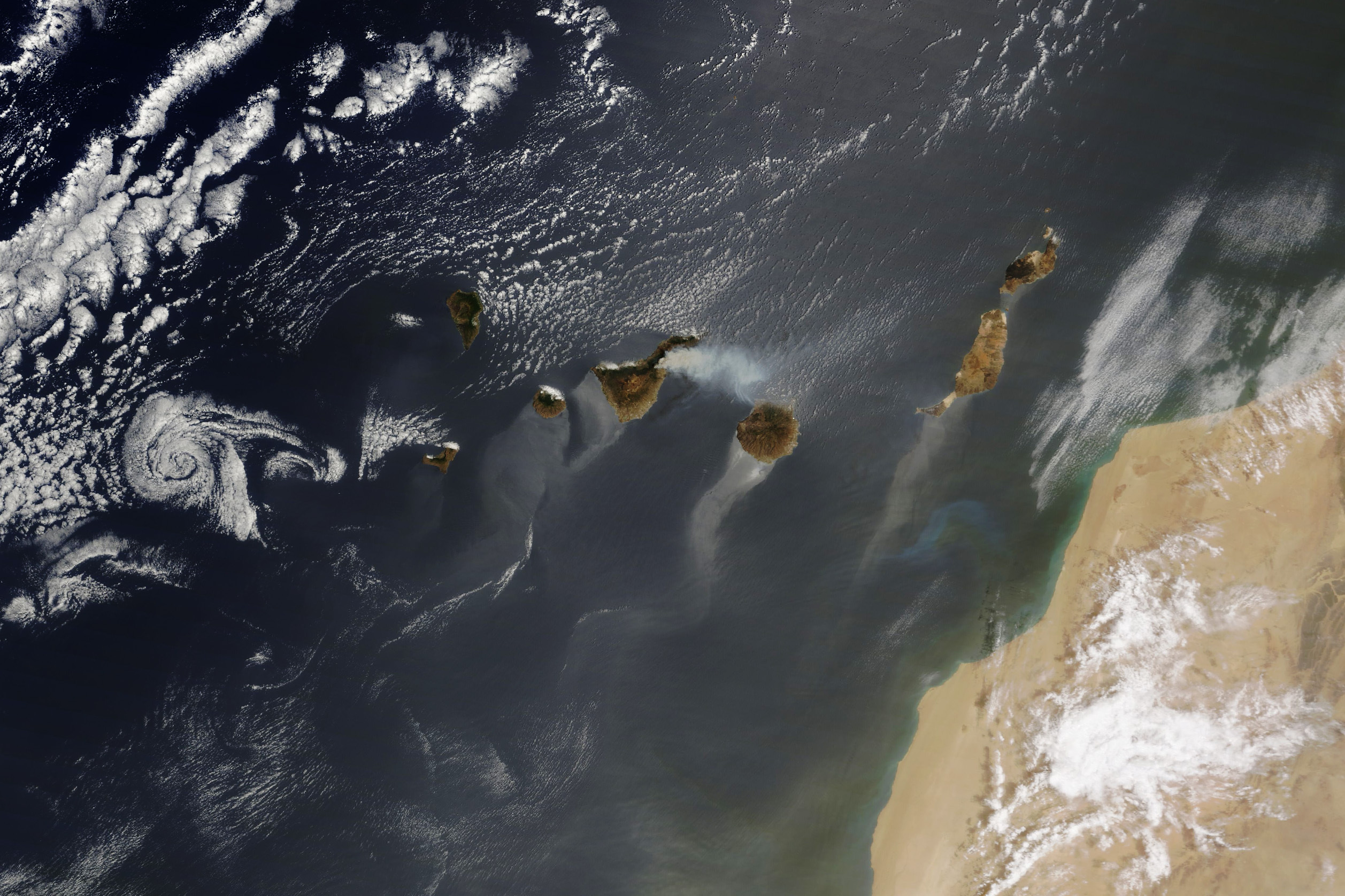
This century has seen a renaissance of lighter than air flight, especially at high altitude (i.e., stratosphere).  Balloons flying higher than 20KM are above most aircraft and below “low earth” orbits.  This location is above 99% of the atmosphere, which is good for looking up and out.  And it is low enough that communications require less power and have lower lag than satellites.

This winter, Lucas Laursen reports on yet another permutation, “very low earth orbit” (VLEO) [1].  The idea is for orbiting satellite to orbit much lower than the usual 300+ KM, down to 100KM or so, closing the gap with balloons and high flying aircraft.

Aside from directly measuring this part of the atmosphere, such a low orbit might be useful for communications (low lag) and, of course, getting a close look at what is below.

To date, these orbits have been rarely used for satellites for good reasons.  Like aircraft and balloons, the lower the altitude the narrower the coverage.  It may take a good number of VLEO satellites to get wide or continuous coverage of a target.  This is practical only if many launches are possible and affordable– which is more true today than ever before.

In addition, the atmosphere is thin up at 100-300KM, but it is still there.  Very low orbits decay rapidly because of drag, giving a missions a limit of six months or less.  Developers are exploring hybrid orbiters that extend missions through aerodynamic shapes and / or thrusters.

The minimal atmosphere offers other challenges.  Conditions vary from night to day, and with other variables.  This makes the orbits less predictable and may interfere with operations.

The atmosphere protects against some of the radiation in orbit, easing some design requirements.  But there is atomic Oxygen at this altitude, which is really, really corrosive

It looks like the combination of more abundant and cheaper launch costs with lower development costs is making commercial fleets of VLEO potentially feasible.  This will probably mean thousands of satellites whizzing by at low altitude.

I’m not totally thrilled at the prospect of yet more stuffy blocking my view of the sky. 

I guess, some good news is that VLEO satellites burn up pretty quickly, so there shouldn’t be much space junk at this altitude.  On the other hand, there could be a continuous rain of deorbiting VLEOs.

Personally, I’m partial to solar powered balloons and light aircraft, AKA, pseudosatellites.  But I know these will never cover all possible use cases, it’s just geometry.  As long as there is money to be made and intelligence to be gathered, every possible altitude may be filled with instruments.


  1. Lucas Laursen, Civilian Satellites Descend Into Very Low Earth Orbit, in IEEE Spectrum – Aerospace, December 14, 2023. https://spectrum.ieee.org/vleo

A Bit Of Everything Visible in One Satellite Image

This summer NASA’s MODIS satellite captured a neat image of the Canary Islands and vicinity [1].  On August 16 the satellite recorded:

  1. Smoke from a large wildfire on Tenerife
  2. Eddies in the clouds, downwind of the islands
  3. Dust from the Sahara over the Atlantic
  4. A birght blue patch, likely a bloom of phytoplankton, which might have been feeding on tasty dust from the Sahara
  5. Several sun glints
NASA Earth Observatory image by Wanmei Liang, using MODIS data from NASA EOSDIS LANCE and GIBS/Worldview. (From [1])

  1. Lindsey Doermann, An assortment of natural phenomena visible from space appeared together in one image, in NASA Earth Observatory – Image of the Day, August 17, 2023. https://earthobservatory.nasa.gov/images/151711/a-dynamic-day-over-the-canary-islands

Ice Penetrating Radar On A UAV

The ice is melting everywhere, that much is clear.  Actually understanding the Earth’s cryosphere isn’t simple:  there’s a lot of ice, it’s quite dynamic and changes all the time, and we can’t see most of it.   One of the most important scientific campaigns of my lifetime has been satellite observations of the poles and other icy places.

One of the important measurements has been readings from under the depths of the ice, through various means, including radar. 

Unfortunately, radar measurements from orbit tend to be low resolution.  From orbit, inverse square laws dictate that the radar needs a lot of power to penetrate very far in any detail. For this reason, radar studies have been done from the surface and from aircraft—i.e., much closer to the ice.

Of course, each method has its limits.  Ground expeditions are very difficult and cover only a tiny area along the path of march. Aircraft can cover a lot more area, but are very expensive to operate.  (It would take thousands of flying hours to cover Greenland once.)  Satellites have broad coverage, and repeatedly measure the same location on subsequent passes.  But the orbital radar is relatively weak and low resolution.

This summer Stanford researcher Thomas Teisberg discusses developments of a small UAV equipped with ice penetrating radar [1].  The idea is obvious:  a small, inexpensive UAV, flying low, can get high resolution, deep penetrating radar.  With enough UAVs, you could cover huge areas in a lot of detail.

Teisberg’s article has a nice review of the challenges and the advantages of a fleet of UAVs to make these observations.  Uncrewed aircraft are cheaper and safer to operate, and operating at low altitudes (100 m) the radar needs less power and has less clutter than from higher altitudes.

But conventional radar systems are large and heavy—impossible to mount on small, cheap drones.   UAVs we’ve got.  UAV capable radar, we want.

The Stanford group is working on a much smaller and lighter radar system.  They used software defined radio (SDR) technology to create a system that weighs about a kilogram (“featherweight compared with conventional IPR systems”).

The antenna design also required a lot of work.  A conventional radar of these specs would require a really huge antenna that could never fly on a drone.  So they needed to design custom antennas that fit on the wings of a drone, yet still perform well enough. 

They also had to reengineer the drones to reduce interference from the aircraft.  Carbon fiber is a really cool thing to build your UAV, but it is highly conductive which is a really bad thing for a radar system.

They also had fun with their Raspberry Pi.  Raspberrys are really cool and are just the thing for a low cost UAV.  But they aren’t necessarily happy being part of a powerful radar system.  The problem manifested in the form, “we discovered that we could not get a GPS fix on the drone when the radar system was active.” (!) Ultimately, they had to shield the Raspberry to reduce the effects of noise from the radar signals.

I always say, the fun of computers is finding out what they do!  It’s one thing to have a drone with a down pointing radar.  It’s another thing to get meaningful data with it:

“After one of our test flights, I discovered that the data we had collected was almost entirely noise.”

Ultimately, the prototype has worked well enough to move forward with an effort to build a fleet of larger drones.  They envision UAVs with an 800km range deployed at 11 Antarctic research stations.  This would cover the entire coast of Antarctica with high resolution, near real time measurments.

Cool!


  1. Thomas Teisberg, Studying Climate Change with an Ice Radar Drone in IEEE Spectrum – Climate Tech, Augues 5, 2023. https://spectrum.ieee.org/drone-ice-radar

Beavers Fight Forest Fires

…and we can see it from outer space.

There has been a lot of interest in rewilding, which basically goes beyond reintroducing threatened or missing species, to recreating whole ecosystems.  For me, reintroducing Bison to tribal lands is the iconic effort.  And it will end up regenerating a wild prairie, where numerous plants and animals flourish.  These may not be exactly the same prairie as before the European disturbances, but it will be a self-sustained ecology.

In a similar vein, people are working to reintroduce beavers, especially to mountain watersheds.  These animals were the great hydro engineers of North America, modifying vast areas, controlling water resources, and, many would say, creating ecosystems.  Wiping out the beavers and removing their watery homes had many side effects, not least the loss of water supplies and habitats, which were no longer held by beaver ponds.

Reintroducing beavers involves some wonderful techniques.  Building fake beaver dams (Hey, beavers!  Look!  This is a great place for a dam!)  Also, tossing sticks in the water down stream.  (Look at all this tasty food!  Come see where it came from!)

Restoring beavers to wild streams is good for the rodents, but also is good for fish and other wildlife.  It also builds a lot of healthy, green vegetation, widening the riverscape and improving the whole area [3]. It also retains the spring runoff longer, effectively increasing the water supply for the whole area. 

This summer, NASA reports some satellite images show these beaver created green space [2]. Yes, they are big enough to be seen from space! 

Another remarkable thing is how well the beaver habitats survive wild fires.  These areas become important refuges for wildlife, and surely help the area survive and recover from fire damage.

As Kaitlin Carpenter discusses, monitoring these rewilding efforts is not so easy[1].  Going out to visit beaver streams is laborious and time consuming.  (Heck, once they get going, you never know exactly where beavers will move next.) 

NASA is encouraging and enabling the use of satellite imagery to monitor the status of these beaver areas.  Satellite imagery is available all the time, and it shows a continuous record of ow things change.  It also covers wide areas, including everything, not just the specifically targeted area.


  1. Kaitlin Carpenter, Researchers Become “Beaver Believers” After Measuring the Impacts of Rewilding, in NASA Earth Sciences, July 17, 2023. https://www.nasa.gov/feature/researchers-become-beaver-believers-after-measuring-the-impacts-of-rewilding
  2. Kathryn Hansen and Kaitlin Carpenter, Plants are abundant along Baugh Creek, thanks to the ponded water from beaver dams, in NASA Earth Observatory – Image of the Day, July 24, 2023. https://earthobservatory.nasa.gov/images/151591/idahos-emerald-refuge
  3. Peter Skidmore and Joseph Wheaton, Riverscapes as natural infrastructure: Meeting challenges of climate adaptation and ecosystem restoration. Anthropocene, 38:100334, 2022/06/01/ 2022. https://www.sciencedirect.com/science/article/pii/S2213305422000157

Sahara Dust Over Florida

(The New York Times takes pleasure reporting on trials and troubles from Florida (and California, and Texas.  Etc.)  : – ))

This month Rebecca Carballo reports on a large blast of Sahara desert dust that has drifted across the Atlantic and likely will be over Florida [1]. (I’m sure that the Internet will be able to spin this into a story about how ‘those Saharans aren’t managing their desert right’.) 

While this doesn’t happen every day, it’s hardly a new thing [2]. In general, dust from the land blows out to sea and falls into the water.  This is an important source of nutrients for ocean microorganisms.

Dust plumes happen all the time, and it’s not just deserts.  As icecaps and glaciers melt in the summer or more permanently, they expose eroded rock, which blows into the ocean. This can be similar to a river dumping silt into the sea.  [3]

Actually, Saharan dust doesn’t usually drift as far north as Florida.  It generally falls over the Amazon basin, providing nutrition for the forest there. It’s reasonable to speculate that this cross-ocean river of nutrients has been an important factor in the long term evolution of this ecosystem.

To me, it’s really cool to realize that “wasteful” erosion which strips away soil from Northern Africa is actually regularly redistributing it onto rich forests in South America!


  1. Rebecca Carballo, Saharan Dust Blowing Across the Atlantic Could Reach South Florida, in New York Times. 2023: New York. https://www.nytimes.com/2023/07/09/us/sahara-dust-florida.html
  2. Michael Carlowicz, Sara Pratt, and Kathryn Hansen, A fresh supply of airborne particles took off from northwest Africa in early June 2022, in NASA Earth Observatory – Image of the Day, June 7, 2023. https://earthobservatory.nasa.gov/images/149918/a-burst-of-saharan-dust
  3. Adam Voiland, A seasonal shift in the winds often sends dust from Africa streaming over the Red Sea, in NASA Earth Observatory – Image of the Day, June 30, 2023. https://earthobservatory.nasa.gov/images/151519/dust-pours-through-tokar-gap

A76 is Breaking Up

Iceberg A76 split off from its Antarctic ice shelf just over two years ago, heading out into the Weddell sea.  At birth, she was the largest iceberg ever recorded.  She’s been drifting north since then, melting away in the relatively warm Atlantic.

This spring (which is the end of the southern summer), the largest remaining fragment is breaking up off South Georgia [1].   This area sees plenty of floating ice from the south, and a lot of bergs melt and break up near South Georgia.

May 24, 2023. Image Credit: NASA Earth Observatory image by Wanmei Liang, using MODIS data from NASA EOSDIS LANCE and GIBS/Worldview. (From [1])

Given the enormous size of A76, it has had a slightly surprising short lifetime.  Other bergs have lasted longer.  But A76 has apparently caught some fast currents which drove her north rather quickly, and that’s where icebergs melt.

As noted before, icebergs calving off ice shelves is normal, and not necessarily related to climate change.  Since we have pretty limited historic data about southern icebergs, it is hard to say whether the behavior is changing or not.  A76 was the largest known iceberg, but we have very few measurements before the satellite age, so who knows what big bergs no one saw.

In any case, calving icebergs don’t affect sea level because the ice shelf is floating on the ocean already.  Of course, if an ice shelf breaks up completely, releasing glaciers on land to flow faster, this could eventually result in depositing more ice into the ocean, raising sea level. 

Anyway, ‘adieu’ to A76, biggest berg ever!


  1. Kathryn Hansen, The waters off the remote island of South Georgia splintered another Antarctic iceberg, in NASA Earth Observatory – Image of the Day, June 2, 2023. https://earthobservatory.nasa.gov/images/151411/shrinking-iceberg-a-76a

Dust Nourishes Oceans

We know that outflows from rivers and dust clouds from deserts fertilize the oceans, feeding the plankton that everything else feeds on.  (Dust clouds also fertilize the land.) I hadn’t really groked how important this is to the Carbon cycle.  Plankton are a significant sink for atmospheric Carbon, which means that dust storms promote Carbon sequestration and cool the planet. 

It is easy enough to see major dust storms and the giant plankton blooms that follow.  But it has been difficult to estimate how much dust contributes to plankton overall.  There is always dust falling from the air, and it can’t drift a long, long way over the ocean. So the effects are potentially everywhere, even when there isn’t a massive storm.

NASA has been studying how to measure this process from satellites.  For one thing, this work suggests that iron is a key nutrient that comes from dustfalls.  Iron is relatively rare in the oceans, so a sprinkle of iron-y dust from the sky can be an important boost for plankton.  This hypothesis has been supported by experiments.

In satellite images, phytoplankton is green, so careful analysis of the color of ocean water is used to assess the amount of plankton present [2]. (I gather that there is an entire discipline studying “ocean color”. : – ) )

This spring, researchers at Oregon State and UMBC report a study that correlates estimates of dust falling with ocean color over the whole planet [1].

Estimating how much dust falls where is pretty complicated.  Obviously, dust is carried by winds.  But where it falls depends on many factors, including the composition of the dust, precipitation, and so on.  Furthermore, dust from different places carries different chemicals.  Which all means that the slow, constant, but tiny rain of nutrients is quite variable from place to place and day to day.

The effects of nutrients are estimated from satellite imagery processed to reflect the level of chlorophyll at the ocean surface.  This reflects the presence and health of plankton.  The study shows that likely deposition from large dust clouds is followed by increased chlorophyll a few days later.

The picture is a bit complicated.  Near the equator, plankton are fairly stable year round.  Here, the tasty dust tends to make the plankton healthier, but not increase the amount of plankton.  Near the poles, however, plankton is highly seasonal.  Here, dust falls tend to produce blooms of growth.

The researchers took these estimates of the surface plankton and modelled the effects on Earth’s Carbon.  They find that the dust deposition contributes about 4.5% of the global “export” of Carbon (i.e., from the atmosphere into the ocean).  In some places dust contributes much higher percentage, up to 40%. A modest contribution to cooling the planet, but a contribution nevertheless.


It is interesting to see that wind erosion and aerosols that are generally not good for people or the land actually have good effects for the ocean and the planet. 

The researchers note that climate change will likely cause changes in all these variables in the near future.  As land areas get drier or wetter, there will be changes in dust, and changes in wind patterns and precipitation will alter the delivery of dust over the oceans.  Which means that the supply of nutrients from dust may increase or decrease in different places and times.


  1. T. K. Westberry, M. J. Behrenfeld, Y. R. Shi, H. Yu, L. A. Remer, and H. Bian, Atmospheric nourishment of global ocean ecosystems. Science, 380 (6644):515-519, 2023/05/05 2023. https://doi.org/10.1126/science.abq5252
  2. Sally Younger and Michael Carlowicz, How Desert Dust Nourishes the Growth of Phytoplankton at Sea, in NASA Earth Science News, May 10, 2023. https://www.nasa.gov/feature/esnt/2023/how-desert-dust-nourishes-the-growth-of-phytoplankton-at-sea
  3. Sally Younger and Michael Carlowicz, Researchers have found that even modest amounts of desert dust can improve the health of the ocean’s microscopic, plant-like organisms, in NASA Earth Ovservatory – Image of the Day, May 13, 2023. https://earthobservatory.nasa.gov/images/151330/how-desert-dust-nourishes-phytoplankton

Interesting Satellite Design

It’s not origami—it’s knitting!

One of the perpetual challenges for spacecraft is the need to have large antennas, launched in small, compact rockets.  Spacecraft have to unpack and deploy complex arrays without human assistance, and with no hope of on the spot help if something goes wrong.  The whole mission will be lost if that umbrella doesn’t open like it is supposed to!.

In recent years, engineers have looked at many interesting techniques for unfoldable shapes, including inspirations from biology and origami. 

This spring, Oxford Space showed off a new springy radar antenna that is an umbrella like dish, made of a flexible titanium fabric [1].  The fabric is knitted.  Not by hand, but with an industrial knitting machine, which are pretty cool in and of themselves.

The input to the knitting matchine is very fine gold-plated titanium wire, which produces a beautiful, light, strong fabric.  OK, this cloth is probably a bit pricey for everyday use!  But it’s got to stand up to outer space, and there is no chance to fix a rip or scuff.

The overall mechanism is simple. The ribs snap into form when released, pulling the fabric tight.  No motors, cables, hinges, etc. to go wrong.

“The gold-plated tungsten mesh is attached to series of carbon-composite rods which can be wound radially against a central hub.”

(from [1])

The resulting dish is part of a 3- or 5-meter radar dish.  From orbit, this should have resolution less than a meter. 

Pretty neat.


  1. Jonathan Amos, UK ‘knitted satellite’ will see Earth day or night, in BBC News – Science & Environment, May 5, 2023. https://www.bbc.com/news/science-environment-65483204

Global Assessment of Glaciers

One of the most visible changes on this planet has been the retreat of the glaciers.  This has been noticeable, indeed, obvious in many locations.  And a lot of us suspect that glaciers are retreating rapidly everywhere.

But there are a lot of glaciers, and it’s not that simple to measure them.

This is a job for satellites!  And, indeed, ESA is planning a new satellite, tagged Cristal, that will measure glaciers.  Meanwhile, we have ESA’s old-lady, Cryosat, still working significantly past her design lifetime.  

This spring, (bourgeois?) researchers at Edinburgh and Strasbourg report an analysis of radar altimetry data collected by Cryosat from 2010 to 2020 to estimate the mass changes in glaciers for the whole planet [2].  There’s life in the old girl, yet!

If I understand correctly, the basis of the study is a refined technique to infer the “mass discharge”, i.e., how much ice is being moved down the glacier.  Other measures give estimates of changes in ice from thinning, but for glaciers (as compared to, say, ice caps) the contribution of “discharge” varies, but is significant.

I gather that this dynamic loss is difficult to measure from older satellite data.  It obviously requires the right temporal coverage, i.e., repeated measures of the relevant areas.  The technique described here infers the change in ice mass from thinning and discharge (but not from retreating frontage).

Over the ten years covered, they estimate that altogether the Earth’s glaciers lost 2% of their mass.  Most of that loss (89%) was from thinning, but in some areas, such as Russian Arctic islands and South America, accelerating discharge was a large contribution to the losses. 

Glacier mass changes between August 2010 and August 2020. The regions displayed are Alaska (ALA), Arctic Canada North (ACN), Arctic Canada South (ACS), Greenland Periphery (GRL), Iceland (IC), Svalbard (SV), Franz-Josef-Land (FJL), Novaya Zemlya (NZ), Severnaya Zemlya (SZ), High Mountain Asia (HMA), Southern Andes (SAN) and Antarctic Periphery (ANT). The size of the circles is proportional to the mass loss, with the thickness of the line representing the uncertainty (1-sigma). The inner circle slice (purple shading) displays the proportion of mass loss due to discharge anomaly (Da). The numbers display mass change in Gigatonnes per year [Gt yr−1]. Glacier location based on the Randolph Glacier Inventory 6.0 masks are indicated in red. Graph (a) displays total cumulative monthly mass changes in Gigatonnes [Gt] (gray line and shading, left y-axis), annual mass change [Gt] (red bars and error bars, right y-axis) and 3-year averages of annual mass changes (red dotted line, right y-axis). Graph (b) displays various published global estimates of global mass change and their respective time spans with 1-sigma uncertainties. Our estimates for Greenland and Antarctic peripheral glaciers are added to Ciracì et al. (2020) and Wouters et al. (2019), which both do not distinguish between peripheral glaciers and ice sheet mass change. (From [2])

“We estimate a global mean mass loss of 272 ± 11 Gt yr −1 (1-sigma uncertainties) between 2010 and 2020, which corresponds to a loss of 2% of global glacier ice volume.”

([2], p. 4)

These findings suggest that the bulk of the loss of ice is due to warming atmosphere, though the areas with high discharge losses are affected by sea temperatures [1].

The new Cristal satellite will be able to measure these changes in the ice on into the future.  Ideally, Cryosat will hang on until Cristal comes on line after 2028, so we can get an overlapping dataset. 

Anyway, it’s always good to see new results squeezed out of old satellite data!


  1. Jonathan Amos, Climate change: Satellite maps warming impact on global glaciers, in BBC News – Science & Environment, April 28, 2023. https://www.bbc.com/news/science-environment-65399580
  2. Livia Jakob and Noel Gourmelen, Glacier Mass Loss Between 2010 and 2020 Dominated by Atmospheric Forcing. Geophysical Research Letters, 50 (8):e2023GL102954, 2023/04/28 2023. https://doi.org/10.1029/2023GL102954

Greenland is Melting Inland Too

Greenland is melting, especially at the coasts where ice meets the ocean.  We know that ice is thinning and receding at the edges, but it’s a lot harder to measure farther inland.

This winter, researchers from Denmark and other countries report a study of one important case, the Northeast Greenland Ice Stream [1].  Using satellite data, remote sensing, and ground receivers, the study estimated the position and movement of the ice stream from 2007 to 2021.  This covers the ice stream hundreds of kilometers inland, including the entire length of two ocean terminating glaciers.

The integrated model indicates that the ice is thinning and accelerating faster than earlier models.  There was a major event in 2012, when an ice shelf collapsed.  This new study shows “that extensive speed-up and thinning triggered by frontal changes in 2012 have already propagated more than 200 km inland”. ([1], p. 727)  I.e., when the ice at the ocean disappeared it released the glaciers to flow more quickly.  This has had a rapid and detectable impact.

This is further evidence that Greenland’s ice is rapidly melting into the ocean.  This will contribute to rising mean sea level.  This study calculates that “this marine-based sector alone will contribute 13.5–15.5 mm sea-level rise by 2100 (equivalent to the contribution of the entire ice sheet over the past 50 years)” ([1], p. 727)   Overall, they predict much higher sea level changes than previous studies.

This is becoming a pattern. Every new study improves the measurements of the ice, and every new measurement increases the estimates of ice loss. The bottom line is that Greenland is melting really fast, pretty much everywhere. In a few decades, there will be no permanent ice on Greenland at all.

Wow. And, “glub”.


  1. Kathryn Hansen, Greenland’s largest ice stream is expected to contribute more to sea level rise than models previously indicated, in NASA Earth Observatory – Image of the Day, January 7, 2023. https://earthobservatory.nasa.gov/images/150801/thinning-of-the-northeast-greenland-ice-stream
  2. Shfaqat A. Khan, Youngmin Choi, Mathieu Morlighem, Eric Rignot, Veit Helm, Angelika Humbert, Jérémie Mouginot, Romain Millan, Kurt H. Kjær, and Anders A. Bjørk, Extensive inland thinning and speed-up of Northeast Greenland Ice Stream. Nature, 611 (7937):727-732, 2022/11/01 2022. https://doi.org/10.1038/s41586-022-05301-z